


Saint-Barthelemy (EN)
Detailed island vector map
€120.00
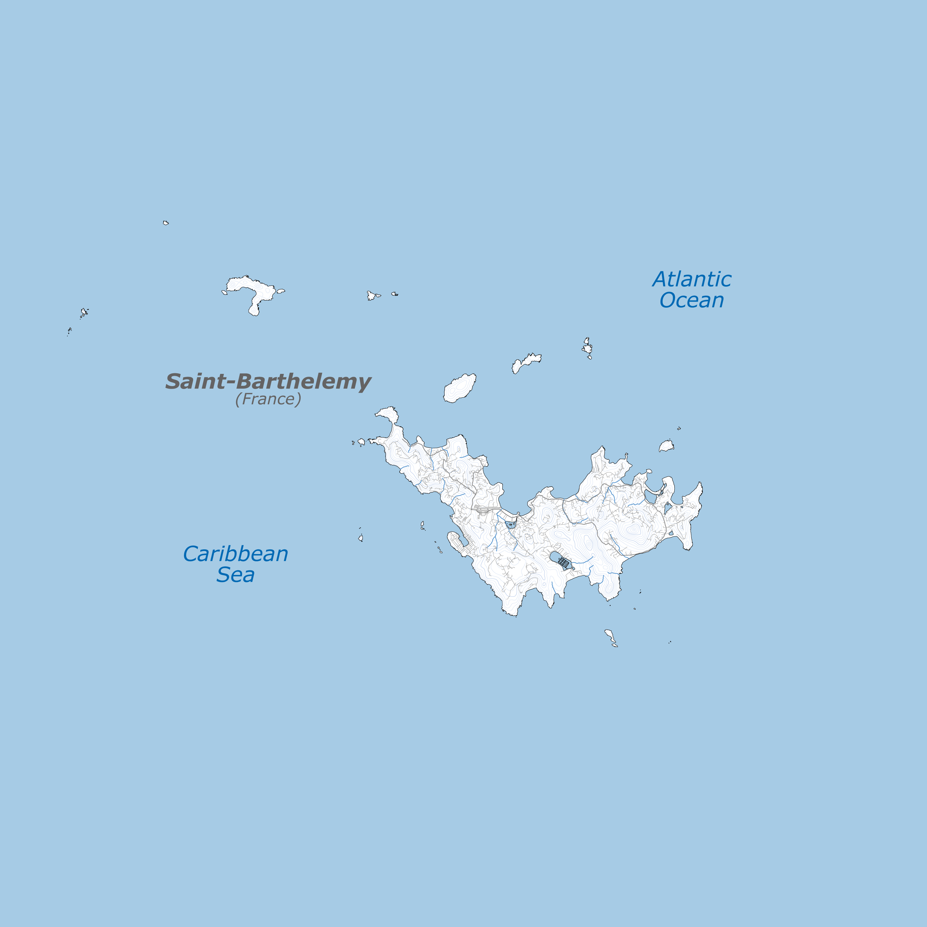
A meticulously crafted vector map, designed to meet the highest standards of accuracy and precision thanks to satellite imagery of the island of Saint-Barthelemy. Perfect for architects, land surveyors, engineers, graphic designers, and artists working with laser cutting.
This map offers exceptional detail and usability. Whether you’re integrating it into your designs or creating functional works of art, it’s a must-have tool for professionals and enthusiasts alike.
A vector map free from defects
• Great precision: The map is drawn at a 1:50,000 scale on a A3 page format (420 x 297 mm) and features a precise graphic scale. It also includes an accurate GPS coordinate grid (latitude and longitude) based on the WGS84 system.
• Ideal for graphic design: The updated and precise shorelines, roads and rivers/ravines provide stunning visual elements for creative projects.
• Optimized for laser cutting: All lines are clean and non-overlapping, guaranteeing flawless results when cutting or engraving.
• Drawing layers: A multitude of well-organized layers, ensuring seamless navigation and endless customization possibilities.
Unparalleled details
• Detailed topography : The topographic lines of the island are detailed at 20-meters intervals, and the major peaks are clearly represented.
• Nature reserve areas: Clearly marked protected zones are ideal for environmental design considerations.
• Border: Features a sharp definition of the boundary between the two sides of the island, ensuring clarity and readability in your work.
• Points of interest: Highlights key locations such as cities, airports, islets, natural pools, and every single beach for added contextual value.
• Up-to-date features: Includes the latest road networks and accurate shoreline mapping based on satellite imagery.
Important note for commercial use
This vector map is available under the CC BY-NC-ND license. For commercial use, permission must be obtained as outlined in the product license terms.
With its accurate map scale, sleek design, and comprehensive detail, this vector map is the ideal solution for professionals working on projects related to the island of Saint-Barthelemy. Whether you’re creating architectural plans, technical models, graphic layouts, or laser-cut designs, this map will seamlessly integrate into your work while helping you save valuable time.
Free updates!
This high-precision vector map will regularly be updated in order to include the latest road networks, any potential changes to the shoreline and other additional details, ensuring it remains as accurate and up-to-date as possible. Download it now and elevate your graphic and artistic projects!
File formats:
.AI .EPS .JPG .PDF .SVG
Updated in April 2025
